"Many history majors turned out to the event, excited to engage with their field of study with the new technology." - Staff Writer / Dan Hassall
On the afternoon of April 9, history-lovers and amateur cartographers alike made their way to the Business Hall to take part in Rowan’s first historical map-a-thon.
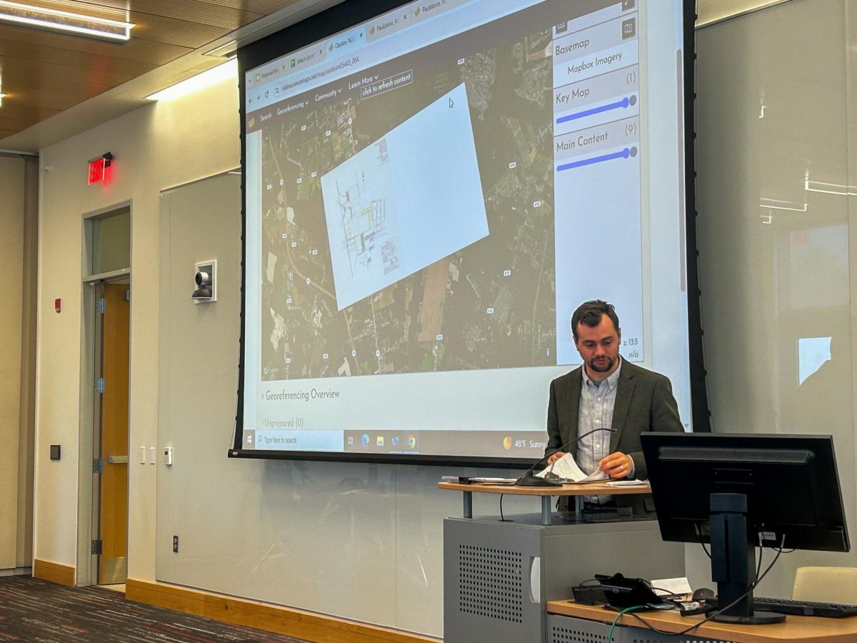
Hosted by Rowan’s Center for Digital Humanities Research, the event served as an opportunity to showcase georeferencing, the process of overlaying an image of an older map overtop a modern digital map, and aligning the image over the digital map through the use of finding common “control points” on the two maps.
“It’s not just the technology,” said Chris Saladin, an assistant professor of history and the leading organizer of the map-a-thon. “It’s looking at history in a spatial way, too, thinking about the role of spaces and geography in historic events.”
Through the use of antique maps of towns across the United States (originally created for reference by fire insurance corporations and archived by the Library of Congress), attendees practiced their georeferencing skills on the maps of towns across Gloucester County.
“What’s incredible about them is that they’re on a town-specific level, even a block-specific level,” said Saladin on the maps used to inform the map-a-thon’s georeferencing. “Essentially what they show you are historical building blueprints, so you can figure out what used to be in a place, what building used to be there, based on these old maps.”
Saladin explained the idea behind the event and the software used.
“The idea of it was to create a kind of web-based GIS platform [Geographic Information System, a digital mapping platform], that allowed us to work with these historical fire insurance maps,” said Saladin. “The platform was developed so that you could take all these different old historic maps and put them into one place.”
Many history majors turned out to the event, excited to engage with their field of study with the new technology.
“It’s pretty interesting, seeing how towns have changed over the years,” said Adam Swider, also a history major.
Along with his team of fellow map-a-thon attendees, Swider worked to overlay maps of Westville, N.J. in 1926 overtop current satellite images of the town.
“It’s something different,” said history major Andrew Aub. “I think it’s definitely interesting, you’re using this to look at old maps and seeing how they overlay over the ones today.”
As the participants practiced their georeferencing skills, Saladin explained where this technology may be useful in history research and education.
“The main application of it is that it allows you to understand how town landscapes, urban landscapes have changed over time,” said Saladin. “Maybe you’re looking in the bigger picture of how a neighborhood’s changed over time whether it’s questions of urban decay, or like a rural town like Glassboro that you had this kind of large university kind of sprout up in it, and you can see basically what used to be there with what’s there today, and understand kind of what the town used to look like.”
Saladin anticipates that the technology could help students and researchers approach history in a new way.
“You can kind of see other ways of doing history that we don’t usually think of,” said Saladin. “We usually think of books and kind of stuffy old things like that, but the reality is that you can use technology like this to look at history in a different way.”
For comments/questions about this story DM us on Instagram @thewhitatrowan or email [email protected]