


!["Working with [Dr. Lynch] is always a learning experience for me. She is a treasure,” said Thomas. - Staff Writer / Kacie Scibilia](https://thewhitonline.com/wp-content/uploads/2025/04/choir-1-1200x694.jpg)


Rowan University’s Geospatial Research Lab’s online visualization platform, NJ MAP, received the 2020 NJ Planning Association Excellence Award for “Outstanding Community Engagement and Education.”
As the most comprehensive online atlas of New Jersey, NJ MAP provides users with free access to a multitude of data collections like ecological resources, environmental education, and sustainable communities.
NJ MAP is possible through the work of geography professor and Director of the Geospatial Research Lab in the Department of Geography, Planning & Sustainability at Rowan University, John Hasse, Ph.D., as well as the American Institute of Certified Planners (AICP), staff, faculty, undergraduate and graduate students at Rowan University. They also receive funding through grants as well as various organizations like nonprofits.
Visitors can view multiple collections, which fragment NJ MAP into relative categories that work together for a particular purpose. The most active for NJ MAP is the New Jersey Conservation Blueprint.
“It serves the conservation community, the people who preserve open space, farmland preservation and environmental management,” Hasse said. “There are hundreds of people using this to help them preserve open space or farmland.”
New Jersey is home to hundreds of organizations dedicated to preserving open space in New Jersey, and they all use data to some degree in order to achieve their goals.
“We work closely with nonprofits like the New Jersey Conservation Foundation and the Nature Conservancy. It’s gratifying knowing that the maps are being used to help preserve land in New Jersey,” Hasse said.
One of the more powerful collections one can view on NJ MAP is the Land Change Viewer, which displays the rapid land use of New Jersey over the past three decades. When you compare it to the New Jersey Conservation Blueprint, you get a good sense of just how much work is being done in the state to combat that growth of development.
Third-year GIS cartography, community and environmental planning and geography major James Cummins discussed how the site helps those conservation efforts.
“NJ MAP is used for many things by many people, but its main attraction is land conservationists. The conservation blueprint project outlined the idea of buildout — the idea that at a certain point all land will be built upon or preserved,” he said. “As buildout approaches, we hope to keep as much of it open space as possible, and that is what I want to see NJ MAP continue to be used for the most.”
As a senior intern for NJ MAP, Cummins helps collect and apply the data using geographic information systems (GIS).
“NJ MAP has been a part of my college experience from the beginning. In my junior year, as it became more pertinent that I complete my GeoClinic, the opportunity came up again for me to apply to intern with NJ MAP. As it was something I was already familiar with, it seemed like an easy choice. I’ve now worked as a part of the NJ MAP team for over a year, and I’ve stuck around long past my GeoClinic timeframe because of how much I enjoy working with this team,” he said.
Cummins first met professor Hasse during his freshman year in Robinson 302, the same room that Hasse attended class in 1993 as a student studying geography.
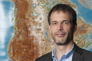
“I’m a graduate of the department I now teach in. It’s excellent; I’d never imagine it. Here I am 30 years later, in the same classroom doing what my professor, Ed Bane, did: teaching about the world and the environment through map,” Hasse said. “It’s more important than ever with all the environmental challenges. We all need to become aware of our environment and world, and mapping allows us to do that in a very powerful way.”
Robinson 302 has evolved considerably since 1993, much like the field of geography. Back then, you would find large drafting tables where students would learn cartography by hand using Rapidograph pens.
“I miss the manual mapping, drawing them by hand. There is an art to it that I’m sad to see lost. Now the NJ MAP project takes computer mapping to the internet. We have hundreds of layers of the map that you can access anywhere in the world instantly. It’s a huge change,” said Hasse.
There are several ways people can use maps to find viable solutions to the problem of land use. One example Rowan students can easily observe is how Rowan Boulevard’s compact development impacted the land use of Glassboro.

“Rowan Boulevard is an example of redevelopment, which helps to save open space by reusing land that has already been developed. It’s a great example of how you can save open space by creating development in a town center, rather than spreading things out in a low-density way that consumes farmland,” said Hasse.
Besides environmental protection, other nonprofit organizations use NJ MAP, like the Fair Share Housing Development, which fights for New Jersey’s affordable housing access.
What NJ MAP does for New Jersey is provide free access to otherwise unavailable — yet vital — data.
“A lot of communities in New Jersey that aren’t wealthy lack the resources to pay for consultants to help them manage. What we do with NJ MAP is make all this information for free; that’s why we get grant money,” Hasse said. “We are aiming at the poor communities as well as the rich suburbs. We want to make this available for the public interest. Environmental information is our main purpose but social information is as well.”
For comments/questions about this story, email [email protected] or tweet @TheWhitOnline.